
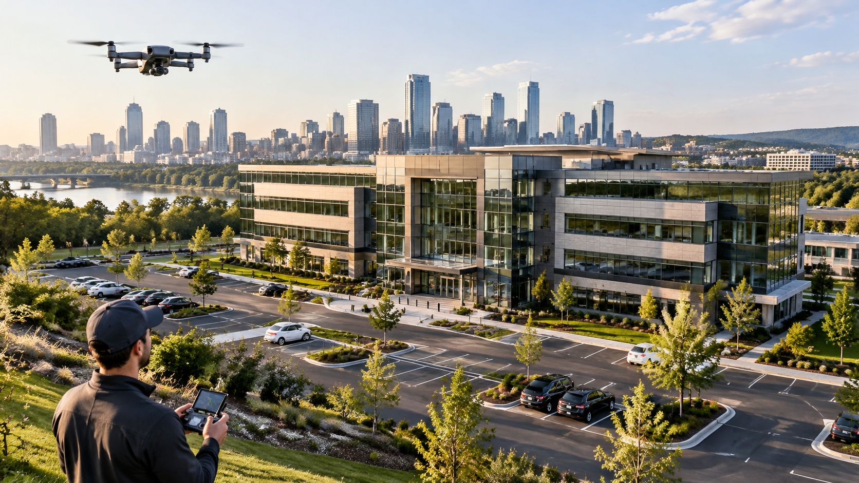
Your leasing team has a vacant building, a deadline, and a ground-level photo that shows little beyond the entrance. Prospective tenants still can't see the loading access, parking arrangement, or relationship to nearby streets. A drone can fill that gap, but ordering attractive aerials alone won't give your facilities team a useful record later.
Good commercial real estate drone photography starts with the decision the images must support. Separate listing visuals from repeatable property records, and separate both from measurement or inspection evidence. Then specify the shots, flight constraints, and deliverables before anyone arrives on site.
Drone Shot Types and When Each Earns Its Place
Start with the listing image, not the maximum flight height. An oblique exterior should make the building recognizable while showing enough ground to explain its access and setting. Climbing higher isn't an improvement if the property becomes a small shape surrounded by unrelated roofs.
The altitudes below are illustrative capture-planning ranges, not prescribed heights or permission to fly. The pilot must adjust them for framing, obstacles, applicable rules, and the site's authorization.
Drone shot types for commercial property
| Shot type | What it shows | Typical altitude | Best property use |
|---|---|---|---|
| Oblique hero exterior | Whole building with surroundings at an illustrative 30-45 degree angle | Illustrative 30-80 m | Listing and leasing marketing |
| Nadir roof plan | Straight-down view of roof, parking and site layout | Illustrative 60-120 m (about 200-400 ft) | Roof condition records and site plans |
| Context wide | Property within neighbourhood, transit links and skyline | Illustrative height up to 120 m (about 400 ft), subject to authorization | Location story for tenants and investors |
| Low façade pass | Entrances, setbacks and material detail close to the structure | Illustrative 10-30 m (about 30-100 ft) | Architectural and façade documentation |
| Dusk or night illumination | Lit façade, signage and parking | Within authorized airspace limits, with compliant night lighting | Retail, hospitality and mixed-use marketing |
| Construction progress frame | Same angle and height on site at each interval | Illustrative 60-120 m (about 200-400 ft) | Developer progress reports |
Choose the view that answers the question
Order the oblique hero first for leasing. Avoid harsh overhead light that creates deep roof shadows and leaves the principal façade unreadable. Choose camera position and sun direction together.
Add the nadir view when roof layout, parking circulation, or construction footprint matters. Its common weakness is presenting visible fences or pavement edges as confirmed legal boundaries. A photograph doesn't establish those boundaries.
A context wide earns its place when access and nearby uses influence the property decision. Don't make the frame so wide that viewers can't identify the asset. A low façade pass adds entrance, setback, and material detail, but pushing close to glass can introduce reflections and unnecessary operational risk.
For dusk imagery, choose a position that balances the illuminated building against the remaining sky. Waiting until the surroundings disappear into darkness often loses useful context. Progress frames need a recoverable camera position and height, not a new dramatic angle at every visit.
Ordering test: Keep a shot if it will still answer a real property question six months later.
Matching Shot Sets to Property Uses
The same building needs different coverage for leasing, capital planning, and construction monitoring. A prospective tenant wants to understand arrival and access. A facilities manager comparing repair work needs matching views, dates, and a clear identification of the roof area.
Treat the following cadences as recommended commissioning schedules, not regulatory requirements. Adjust them to actual changes on the property.
Shot sets and refresh cadence by property use
| Property use | Core shot set | Refresh interval | Deliverable |
|---|---|---|---|
| Sale or lease listing | Oblique hero, context wide, dusk | At listing and after major changes | Edited image set plus short video |
| Multi-building campus | Nadir plan and oblique set per building | Yearly or after capital work | Georeferenced image set |
| Active construction | Nadir progress frame and façade pass | Suggested every 2-4 weeks | Dated image log with fixed angles |
| Roof and façade records | Nadir roof plan and close façade passes | Before and after each repair cycle | Dated image set for facilities files |
| Portfolio baseline | Standard full set per asset | Baseline, then yearly | Searchable archive with metadata |
Build a record someone else can retrieve
For a campus, assign each building a stable asset identifier before capture. Otherwise, similar roofs and repeated building forms become difficult to distinguish once files leave the photographer's delivery folder. If georeferencing matters, specify what it means in the contract rather than assuming embedded location metadata is a mapping deliverable.
A portfolio capture protocol should record camera orientation, altitude reference, framing, season, and lighting conditions. Matching those variables helps reviewers distinguish physical change from a different viewpoint or shadow pattern. Adding fresh angles at every visit can make the collection more attractive while making comparisons less useful.
Use filenames that combine the asset identifier, capture date, shot code, and revision status. Preserve original metadata, keep edited files separate, and include a simple index connecting each view to its building or roof zone.
An enterprise drone-program discussion describes the move toward operational oversight and documented procedures. Property owners can apply that discipline without building an in-house aviation department.
Order the shot set that supports the decision. Set the refresh interval by how quickly the property changes.
Flight Rules Before You Fly in the US and EU
| Requirement | US (FAA Part 107) | EU (EASA open category) |
|---|---|---|
| Pilot credential | Remote Pilot Certificate | Registered operator with training appropriate to the subcategory |
| Aircraft registration | Registered and marked | Operator registration generally required for camera-equipped drones that aren't toys |
| Maximum height | Generally 400 ft above ground, with a structure-related exception | Normally 120 m above ground |
| Visual contact | Visual line of sight | Visual line of sight or assisting observer |
| People on the ground | Restrictions on flight over uninvolved people | No flight over assemblies of people |
| Airspace | Authorization in controlled airspace, often through LAANC | Check geographic zones and applicable national restrictions |
| Remote ID | Confirm applicable registration-linked identification requirements | Active Remote ID for applicable class-marked aircraft |
| Night flight | Required training and compliant anti-collision lighting | Confirm applicable category, aircraft-lighting, and geographic-zone conditions |
Drone photography is a regulated aviation activity, not just an equipment service. The US Part 107 regulations establish the Remote Pilot Certificate framework, visual-contact requirements, restrictions over people, and the general 400-foot height limit, including the conditional structure-related exception.
The corresponding European open-category guidance normally limits flights to 120 metres above ground, requires visual contact, prohibits flights over assemblies of people, and generally requires operator registration for camera-equipped drones that aren't toys. Registration belongs to the operator, so a request for an aircraft registration document shouldn't substitute for checking the applicable European requirements.
The rules that change the shot sequence
A credential doesn't authorize every proposed camera move. A building may hide the aircraft halfway through an orbit, while an occupied entrance may make the planned route over people unsuitable. Quote separate repositioning points rather than promising an uninterrupted circuit.
Controlled airspace also changes planning. The FAA's small-drone rule explanation distinguishes authorization requirements in Class B, C, D, and E airspace from operations in Class G airspace, which generally don't require that authorization. Around metropolitan properties, including Atlanta, check the actual airspace instead of assuming that a low flight is automatically permitted.
Identification requirements need their own check. The European open-category operating guidance specifies active, updated Remote ID for C1, C2, and C3 drones from January 1, 2024, alongside applicable registration-number display and upload requirements. Don't assume every aircraft follows an identical identification pathway.
For illuminated façades, the FAA's airspace authorization guidance requires night-operation anti-collision lighting visible for at least 3 statute miles, along with applicable pilot and airspace conditions. Camera navigation lights aren't a substitute, and night permission doesn't remove restrictions on people or visual contact.
Perspective Flights Versus Mapping Flights
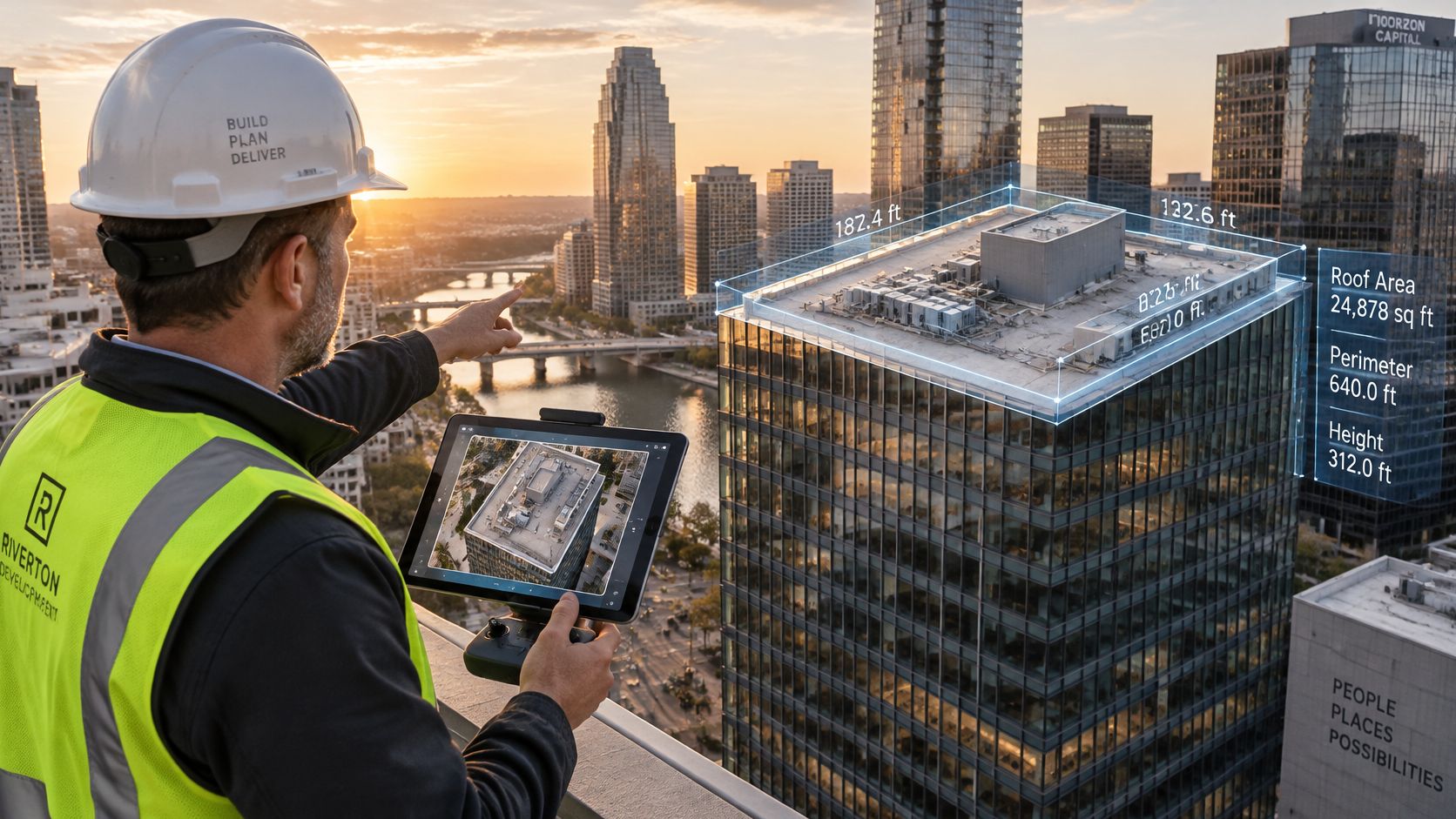
Say a developer orders a cinematic exterior flight, then asks for roof dimensions from the finished footage. The building looks sharp, but the camera angles, coverage, and positioning weren't designed for measurement. Converting that footage into a dependable dimensional record isn't an editing task.
A tablet display can make measurements look authoritative without showing how they were established.
Specify the capture method before the flight
A perspective flight prioritizes composition, façade geometry, and controlled camera angles. The photographer can change height and position to separate the building from its background or reveal an entrance.
A mapping flight prioritizes consistent coverage. It needs planned overlap, stable exposure, suitable altitude, and reliable ground-control or georeferencing information. A gap that doesn't matter in a marketing sequence can prevent dependable reconstruction of a roof edge.
Ground sampling distance, or GSD, describes the ground represented by an image pixel. The photogrammetry accuracy and quality-control guide gives a conditions-dependent benchmark: imagery at approximately 3 cm GSD can produce roughly 3-6 cm horizontal RMSE and 6-9 cm vertical RMSE under good conditions.
Smaller ground pixels provide detail, but they don't independently establish final accuracy. Camera calibration, overlap, motion blur, lighting, terrain texture, and georeferencing all affect the result. A smooth, uniform roof can also provide fewer distinctive features for matching than a textured site.
The distinction matters when evaluating any demonstration of drone-based measurement.
Put accuracy and limitations together
A target GSD isn't a survey-grade designation and doesn't replace a licensed survey. RMSE describes an error measure, not a promise that every point falls within the same distance of its true position.
For the hypothetical developer, the correct response is a separately scoped mapping capture, not an unsupported measurement extracted from attractive footage. A site-surveying photography scope should distinguish image documentation from professional surveying responsibilities.
Put these items together in the proposal:
- Intended use: Marketing, roof documentation, construction monitoring, or site-context analysis.
- Technical specification: Target GSD, expected accuracy, coordinate reference, and control method.
- Acceptance and limitations: How results will be checked, what areas may be incomplete, and which decisions require a licensed professional.
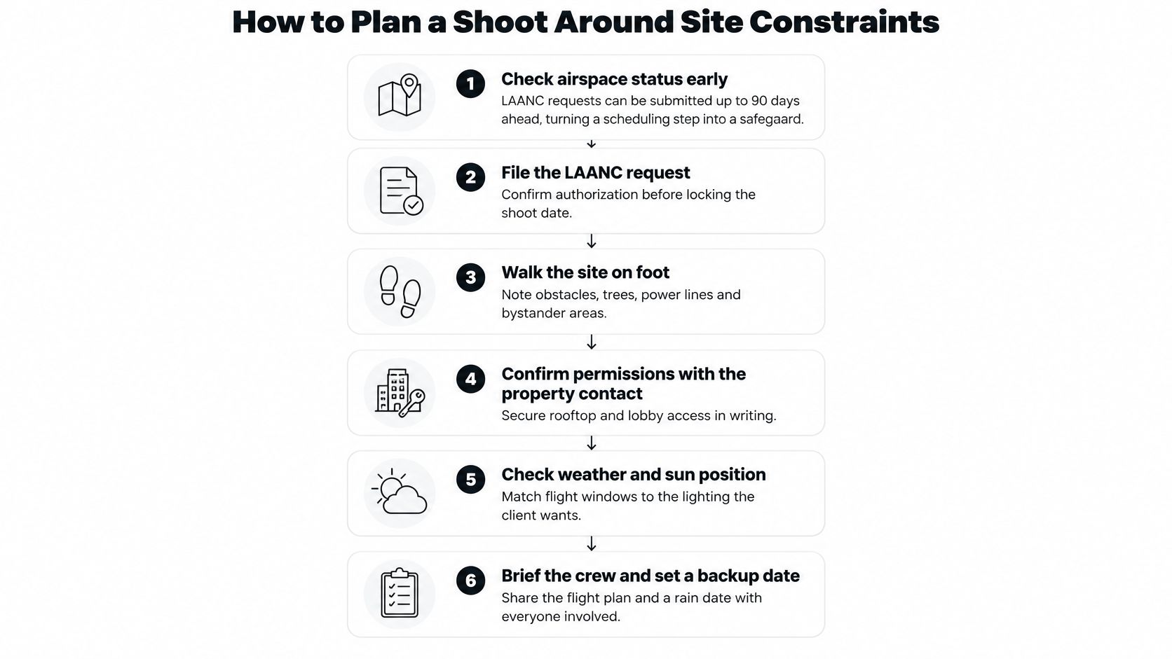
How to Plan a Shoot Around Site Constraints
A workable flight plan connects every requested image to a safe operating position. It also gives the property contact concrete tasks, such as arranging access or keeping a loading area clear, rather than a vague request to prepare the site.
Use this planning sequence to coordinate the people and permissions before capture.
Complete the preflight routine
Check airspace early. The FAA's LAANC guidance allows requests up to 90 days before an operation, with near-real-time authorization available for eligible requests within facility-map limits. Submit the request before treating a preferred capture window as confirmed, and don't confuse a map's displayed altitude with authorization to fly.
Walk the site and mark launch points, observer positions, landing areas, and a clear escape path. Obtain written agreement for needed rooftop, courtyard, or lobby access, because control of the building doesn't guarantee that every proposed operating area will be available.
Test each sight line from the ground. Check trees, towers, rooflines, and neighboring buildings against the intended aircraft route. A clean camera view doesn't prove the pilot or coordinated observer can maintain direct aircraft visibility.
Identify occupants, deliveries, pedestrians, and neighboring activity before drawing the route. Plan exclusion areas and legal repositioning points rather than assuming people will stay out of the way during a long orbit.
Sequence for light and short repositioning legs. Capture the most light-sensitive façade first, then group nearby operating positions to reduce unnecessary setup. Don't preserve an inefficient shot order just because it matches the order in a presentation deck.
Check wind, gusts, cloud cover, sun position, and the intended dusk window. Confirm when façade lighting and signage switch on, since sunset information alone won't tell you whether the building will be illuminated.
Confirm the after-dark configuration. Verify the aircraft lighting, pilot qualifications, and authorization conditions for the planned operation. The common slip is scheduling an illuminated exterior without confirming that the flight configuration supports night work.
Log the flight and capture conditions, then store that record with the image metadata. Record departures from the capture protocol, such as an inaccessible launch point or changed framing, so the next visit doesn't establish a different baseline.
Give the property contact a usable checklist
A project-site preparation checklist should assign access, cleanup, lighting, and occupant communication to named people. Include a backup date and identify who can approve a changed sequence when weather or site activity intervenes.
The plan is ready when every shot has a launch point, a sight line, and a legal flight path. A camera position without those supporting details is still a request, not an executable plan.
What a Commercial Drone Shoot Costs
Price the deliverable, not just the minutes airborne. A short flight can require substantial coordination, while an uncomplicated repeat visit may involve less planning but considerable processing afterward.
For an illustrative multi-building campus needing an annual nadir plan and oblique coverage of each building, request a unified scope with separate building lines. Price a measurement-oriented mapping deliverable separately from the marketing photographs.
Compare equivalent quote lines
- Sites and buildings: Include travel, launch-point setup, airspace review, and sight-line checks.
- Shot set: Distinguish a listing package from full baseline coverage across the asset.
- Refresh cadence: Separate recurring capture fees from initial protocol development.
- Deliverable type: Identify perspective stills, video, georeferenced imagery, and mapping processing individually.
- After-dark work: Include the additional operating window, lighting coordination, and any separate visit.
- Postproduction and records: Specify editing, metadata, file indexing, delivery, and archive handling.
A low quote can exclude exactly what makes the files useful later. Check whether the price includes repeatable framing, an image index, and rights suitable for the intended publication or internal record.
Use a commercial real estate photography pricing framework to organize the comparison, rather than treating an hourly rate as the entire budget.
Budget rule: Compare identical scopes before comparing totals. A marketing image set and a controlled mapping dataset aren't interchangeable purchases.
Privacy, Evidence and the Pre-Booking Brief
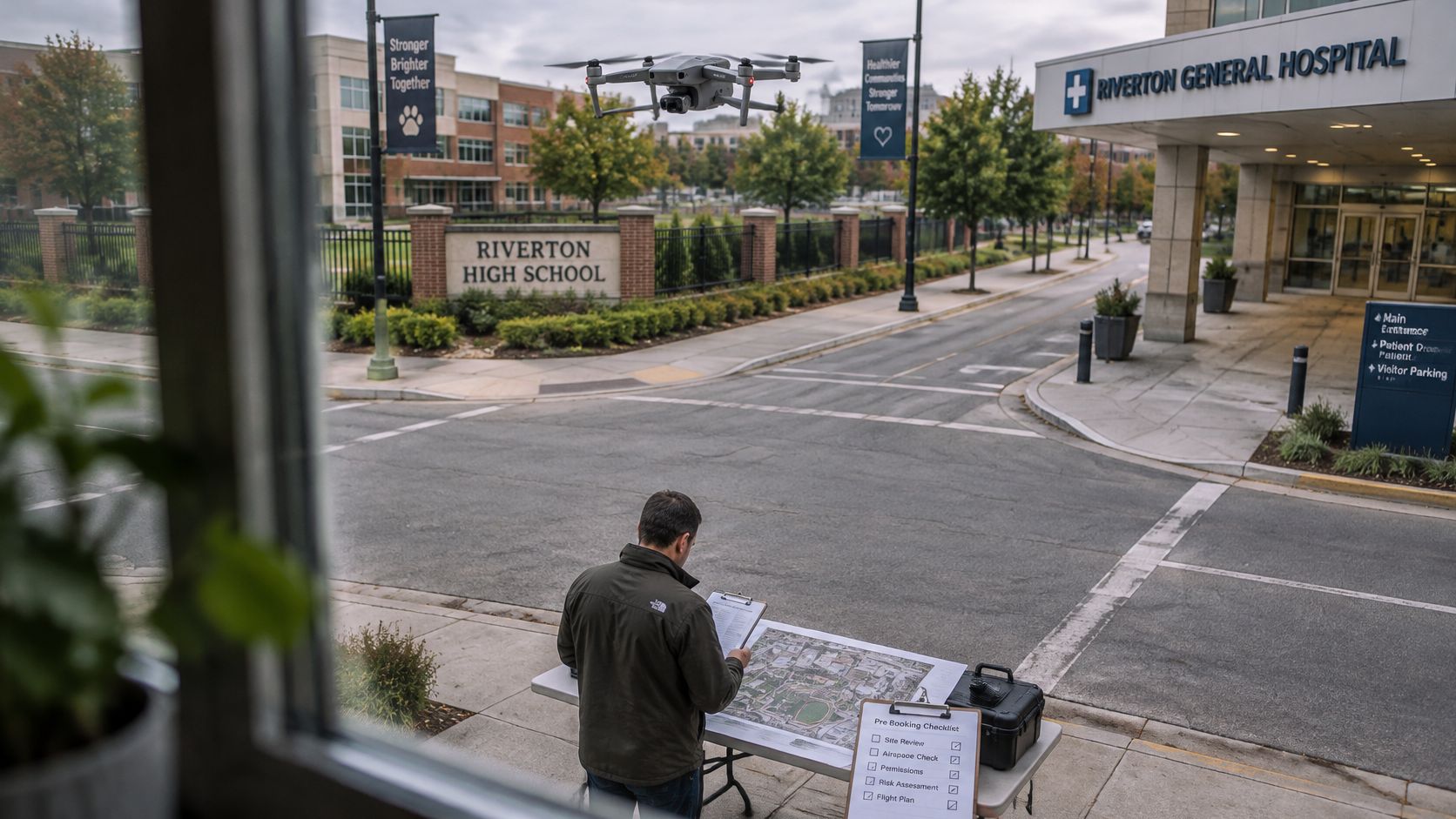
A legal flight doesn't automatically produce a publishable image. A downtown office, school campus, hospital, or construction site can require careful decisions about identifiable people, vehicle plates, visible interiors, and neighboring property.
The real estate drone photography privacy guidance highlights site-specific risk assessment, notices, exclusion areas, alternate launch positions, and decisions about blurring or excluding sensitive content. It also identifies March 2024 as the US Remote ID compliance milestone, making identification arrangements a practical pre-booking question rather than an equipment detail.
The preflight review should address the resulting files as carefully as the flight itself.
Keep visual evidence separate from technical conclusions
A sharp photograph can show apparent staining, displaced material, or an open joint. It doesn't establish structural adequacy, roofing performance, or code compliance. Route those conclusions to the appropriately qualified professional.
Preserve an unaltered source set when images may support maintenance decisions or a dispute. Keep publication edits in a separate branch, with a record of cropping, blurring, or other changes. Removing a distracting object from a listing image and preserving evidence of site conditions are different editorial responsibilities.
Send this brief before signing
State the intended use first. Identify marketing, roof-condition records, construction monitoring, or site-context analysis. Name the people who will use the files and the decision they expect to make.
Where measurement matters, specify target GSD, expected accuracy, coordinate reference, and limitations. Require a clear distinction between photographic coverage and the professional services needed to validate dimensions or boundaries.
Define the shot set and refresh trigger. Attach the required views and identify which property changes justify another visit. State how missing or obstructed views will be documented.
Request the pilot's Remote Pilot Certificate or applicable local equivalent, the airspace authorization plan, and the proposed flight-log format. Check that the operating plan addresses the actual location, not merely the operator's general credentials.
Set the file and privacy requirements. Include proof of insurance, publication rights, blurring policy, retention period, chain of custody, and naming convention. Assign responsibility for occupant notices and final publication review rather than leaving both parties to assume the other will handle them.
Confirm Remote ID arrangements for the aircraft and operation. The written answer should identify how compliance will be checked, not describe the drone as professional equipment.
Require a written capture protocol for recurring work. Include orientation, altitude reference, season, lighting, metadata, and integration with GIS or property-management records. Identify who maintains the protocol when buildings, access arrangements, or personnel change.
Our listed location is Atlanta, Georgia, so location belongs in the opening project details, alongside the property contact and access constraints. Don't assume that a local address removes the need for site-specific planning.
Compare written answers on rules, accuracy, privacy, and delivery before booking. Choose the scope that produces usable records, not just the most dramatic preview frame.
Visit Jimmy Clemmons Photographer to discuss architectural photography for your property, including sweeping exteriors and refined interiors that highlight form, light, and detail. Based in Atlanta, Georgia, we also offer professional editing to support a cohesive presentation. Bring your site list, intended uses, and repeat-capture requirements so the conversation starts with the images your team needs.